Biodiversity habitat projects
A listing of biodiversity habitat projects being undertaken by various groups and organisations across Victoria. Share your project
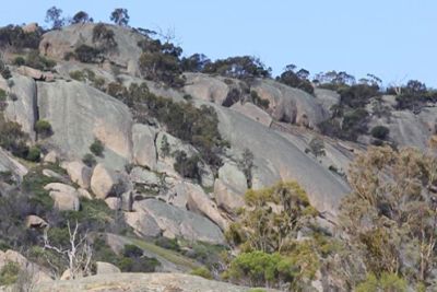
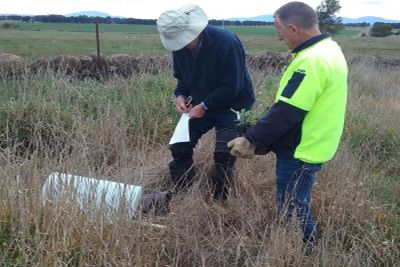
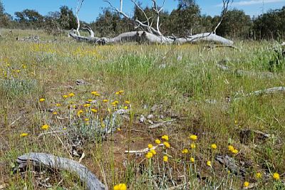
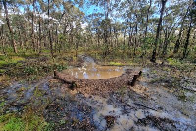
Mt Korong Eco-watch 'Rewilding Korong Ridge'
Location: North Central Victoria, Inglewood and Wedderburn area
Species: 48 listed threatened species and communities, inc. Snowy Mint Bush, Deane’s Wattle, Robust Greenhood, Diamond Firetail, Brown Treecreeper, Hooded Robin and Painted Honeyeater.
Activities: Community plantings revegetation focus on understory restoration inc. nursery, weed, fox, cat control and monitoring.
Partners: Schools, Parks Vic, Dja Dja Wurrung, WCMN, Loddon Plains Landcare Network, DEWLP, NCCMA, Trust for Nature.
Contacts: Kate Lee (Sec. Mt Korong Eco-Watch)
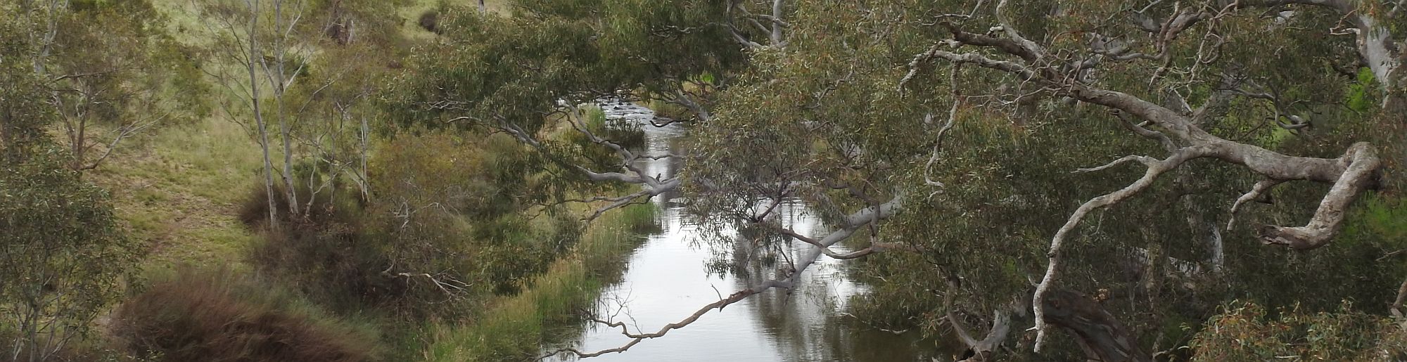
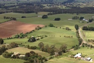
'Bendigo Creek Biolink, Huntly' project
Location: North Central Victoria, Bendigo Creek/Huntly Streamside Reserve
Species: Threat. sp. Brown Toadlet, Grey-crowned Babbler, Hooded Robin, Swifft Parrot, Whirrakee Wattle, Whipstick Westringia.
Activities: Community plantings revegetation to create native vegetation linkages, weed & rabbit control, educational activities, wildlife nestbox installation & monitoring.
Partners: Northern Bendigo Landcare Group, Parks Victoria, local primary schools, Bendigo TAFE Conservation & Land Management.
Contacts: Northern Bendigo Landcare Group
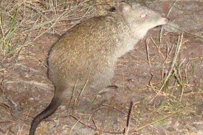
Glenelg Ark
Location: Far south-west Victoria, Lower Glenelg National Park (south), Cobboboonee National Park, Mount Clay State Forest, Discovery Bay Coastal Park.
Species: Focus sp. Long-nosed Potoroo, Southern Brown Bandicoot, Common Brushtail Possum
Activities: Broad-scale and continuous fox baiting using buried Foxoff®. Comprehensive monitoring in treated and non treated areas using remote cameras.
Partners: DELWP, Parks Victoria
Contacts: Glenelg Ark
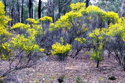
Friends of the forgotten Woodlands
Location: Victorian Volcanic Plains (VVP) Bioregion
Species: Focus sp. Banksia marginata (Silver Banksia) Allocasuarina verticillata (Drooping Sheoke), Bursaira spinosa (Sweet Bursaria)
Activities: Mapping, genetic studies and Establish seed orchards
Partners: Community driven project - input and obs. welcome
Contacts: Aggie Stevenson, Biodiversity Projects Coord. Glenelg Hopkins CMA Ph. 035571 2526
Friends of the forgotten Woodlands
Future Landscapes project 2016
Location: Golden Plains, City of Ballarat, Moorabool, Hepburn and Pyrenees Shires
Aims: Improve understanding of the impacts of projected climate change on the region’s natural assets and respond effectively for the betterment of agriculture and natural resource protection across the region.
Activities: Develop Local Biodiversity Action Plans, climate impact modelling, case studies, tools and materials to ensure simple adaptation actions are integrated within their operations, plans and policies. Workshops pdf.
Partners: Deakin University Centre for Regional and Rural Futures and Centre for Integrative Ecology. LGA's.
Contacts:
- Golden Plains Shire Council - Simon Howland, Environment Services Team Leader 03 5220 7103
- Centre for Regional and Rural Futures - Dr Robert Faggian ,Assoc Professor - Climate Change Adaptation.
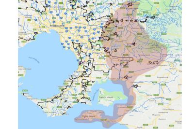
Healesville to Phillip Island Nature Link (HPNL)
Location: From Yarra Ranges to Bass Coast. Healesville Sanctuary, Puffing Billy and Phillip Island Nature Parks) via natural corridors on public and private land.
Aims: Creation of a biolink from Healesville Sanctuary to Phillip Island.
Activities: Phase one planning completed for 150 km route, passing through the City of Casey and Cardinia Shire. Thirty-one related actions have been prioritised and will be implemented depending on support and funding. Planning for the northern (Yarra Ranges) and southern (Bass Coast) sections are to follow.
Partners: HPNL steering committee , Port Phillip Westernport Catchment Management Authority (PPWCMA) , Volunteers needed.
Contacts:
- Dr Pat Macwhirter, contact form
- Strategic Plan (pdf)
Haining Farm Redevelopment: Conservation and Community Park
Location: Don Valley.
Aims: The Haining Farm redevelopment will create much needed need new habitat and food sources for Helmeted Honeyeaters and lowland Leadbeater's Possums. These species are at great risk of extinction in their current location and Haining Farm is one of the very few places in the world that provides the right conditions to create new homes for these special animals at the right scale needed to improve their chance of survival. The best way to educate people about nature is to immerse them in it. Haining Farm Park will be a place where the community can have fun outdoor experiences and learn to love the land they depend on.
Partners: Parks Victoria, Greening Australia, Zoos Victoria.
Contacts:
- info@greeningaustralia.org.au
Using fire to manage biodiversity in fragmented landscapes
Location: Glenelg region.
Aims: Land-use change has severely fragmented Australia's natural landscapes, and remaining habitat fragments are at risk from increases in fire frequency and intensity. Together, fire and fragmentation pose a major threat to biodiversity. Our project addresses two key knowledge gaps: (1) the combined effects of fire and fragmentation on animal movement (2) the implications of current and future fire regimes for native animal populations. We're using the fragmented stringybark woodland of southwest Victoria and southeast South Australia as a study system. Our approach combines field surveys of reptiles, mammals and beetles with innovative genomic techniques and a powerful fire simulation model. We hope our results will help land managers to sustain biodiversity in fire-prone fragmented landscapes.
Partners: University of Melbourne, Monash University, DELWP, DEWNR, Parks Victoria, SA Water, CFA, Glenelg Hopkins CMA, Trust for Nature
Contacts:
- holly.sitters@unimelb.edu.au
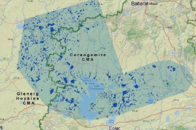
Victorain Volcanic Plains Wetland restoration program
Location: Corangamite and Glenelg Hopkins Regions
Background: Many wetlands across the Volcanic Plains have been drained. Wetland plants and animals rely on water lasting well into spring and early summer. By removing the impact of drains you can make sure wetland dependant species have water when they need it most.
Program: If you have a site you’re interested in working with please get in touch to see hear about what might be possible and what sort of funding is available.
Partners: Nature Glenelg Trust, Corangamite CMA, Glenelg Hopkins CMA, Victorian State Govt.
Contacts:
- Lachlan Farrington
- 0410208717
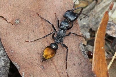
Ants : Adding value to small reserves and remnant vegetation?
Location: South-west ,Central and west Gippsland Victoria.
Background: Ants are present, but not often noticed, in all natural reserves, remnant vegetation and often in suburban parks and domestic gardens. This project is investigating the role ‘common bushland ants' could play in stimulating community interest in support and advocacy for small reserves, remnant vegetation and semi- natural areas in suburban areas.
Activities: Increasing the interest and ability of the community to identify "common bushland ants" in order to stimulate interest in managing areas with remnant vegetation. Focus on Myrmecia Bull ants as a pilot, but also other species of bushland ants.
Partners: Interested community groups etc.
Contact: Peter Muller- "Ants are Everywhere"
![]()
Weed Society of Victoria
Location: State-wide
Background: The Weed Society of Victoria is an organisation for people interested in any aspect of invasive plants (weeds). This might include: terrestrial or aquatic weeds; the biology, ecology, and management of weeds; their place in the environment; their benefits and uses; or their place in history and art.
Activities: Technical Advice & Resources, Education & Training and Partnerhsips & Advocacy.
Partners: Interested community groups etc.
Contact: https://www.wsvic.org.au/
Weeds at the Early Stages of Invasion (WESI) project
Location: State-wide
Background: Invasive species management, including weed management, is an integral component of any landscape or reserve scale conservation program. The benefits of a preventative and early intervention approach has been adopted in many parts of the world with great success.
The WESI Project was created to promote these benefits and enable Victoria to adopt this approach, with a focus on high risk invasive weeds that are in the early stage of invasion and threaten biodiversity.
Activities & contacts: Useful tools, information and catalogue of seasonal newsletters.
Subscribe to the free newsletter.
Social media: @weedyk8 and @bianca gold weeds.
Online events: Weed management after fire webinar series November - December 2020
Grassy Eucalypt Woodlands Stewardship Program 2021 - 2031
Location: Victorian Volcanic Plains
Species: Native grasslands, woodlands including fauna e.g., Fat-tailed Dunnart, Striped Legless Lizard, Golden Sun Moth and Growling Grass Frog.
Program: Support to private land managers to protect critically endangered Grassy Eucalypt Woodlands through 10yr voluntary management agreements (2021-2031). The program includes financial incentives for on ground management interventions, long term monitoring, annual site meetings and landholder forums / workshops. Long-term fauna monitoring program at selected sites.
Partners: Corangamite CMA, Australian Government’s Regional Land Partnership, Landholders, DELWP, Wadawurrung Traditional Owners Aboriginal Corporation, Geelong Landcare Network, Golden Plains Shire, Greening Australia, Trust for Nature, Geelong Field Naturalist Club and community representatives.
Contacts:
- Jess Lill Corangamite CMA
- 0477 719 149
- Information sheet
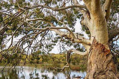
Victorian Murray Floodplain Restoration Project (VMFRP)
Location: Lindsay Island, Wallpolla Island, Hattah Lakes North, Belsar-Yungera, Burra Creek, Nyah, Vinifera, Gunbower, Guttrum-Benwell Forests.
Activities: The VMFRP will remove blockages to flow and build infrastructure such as regulators and containment banks so that we can get water on and off nine Murray River floodplains as needed to improve ecological outcomes and restore floodplain health. The VMFRP is targeting a range of floodplain-dependent species including trees (Red Gum and Black Box), vegetation and animals. Targeted animal species include (but are not limited to) the Regent Parrot, Painted Honeyeater, Growling Grass Frog, Corbens Long-eared Bat, Carpet Python, Gile’s Planigale and Painted Snipe.
Partners: Lower Murray Water, Goulburn Murray Water, Mallee Catchment Management Authority, North Central Catchment Management Authority, Parks Victoria, Department of Environment, Land, Water and Planning.
Contact:
- info@vmfrp.vic.gov.au 0428 516 233
- VMFRP web site
- Information sheet
Glenelg Eden
Location: Far south-west Victoria: Lower Glenelg NP, Cobboboonee NP/FP, Mount Clay SF, Rennick SF, Mount Richmond NP, Discovery Bay CP.
Activities: The Glenelg Eden project is a strategic, landscape scale weed management project that focuses on the detection and removal of high-risk weeds that threaten the biodiversity values of the Far South West of Victoria.
Partners: Parks Victoria, DELWP.
Contact: Mitch Williams, Glenelg Eden Project Officer, DELWP, Barwon South West Region.
Basalt to Bay projects
Green Line Project (Koroit and Minhamite on Victrack asset -planting, monitoring, habitat management).
Doug Fenwick Reserve (biodiversity monitoring & landholder extension program 2022 - 2024).
Pathways to Parks and Pallisters Project (unlicenced road reserve between Barkers Rd, St Helens and the Broadwater Bushland Reserve plus Pallisters Reserve - habitat management and surveys).
Monitoring at Mortlake Common (mapping noxious weeds and native species, on-ground management)
Partners: Parks Victoria, DELWP, St Helens Landcare Network, Friends of Pallisters Reserve, ABP Pty Ltd, adjoining farmers, Moyne Shire Council, Macarthur Primary School, local community, VicTrack and CFA.
Contact:
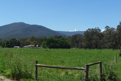
Spring Plains Watershed repair - Biolinks Alliance
Location: Spring Plain Track, Argyle VIC 3523.
Species: Woodland birds.
Program: Spring Plains Watershed Repair is a landscape–scale restoration pilot project that has emerged through the Heathcote Local to Landscape planning process.
The pilot takes a local hotspot for threatened woodland birds and aims to repair landscape health and build resilience to climate change by scaling–up measures like soil amelioration that help make watersheds more absorbent and productive. The project aims to demonstrate how to repair past environmental damage and why the approach is urgently needed more broadly in the region.
Partners: Citizen Scientists undertaking baseline monitoring of flora and fauna. Biolinks Alliance.
Contacts: